Tuesday, May 22, 2012

Spectacular views of Eilat and beyond

This morning I took another hike in the hills. In order to save a little time, I started by driving the car to a spot a short distance up highway 12. The drive took about 6 minutes, but it would have taken 15-20 minutes to walk there.

From that point, there is a bicycle trail through the hills over to Nakhal Shakhamon. In fact, there are LOTS of bicycle trails like this in the hills near here. They might be just a bit scary for me to ride my bike on (I haven't actually tried yet), but they are GREAT for hiking!

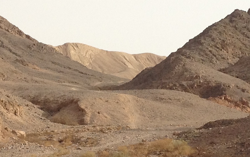
When I reached Nakhal Shakhamon, I followed the gravel road for a short distance and then turned left on a trail in a narrower canyon. The trail is well marked, but it shortly begins to go up a very steep part of the canyon towards a saddle. Even from way down, one can see that there are two power-line towers up in the saddle. In fact, there is even a gravel road up the other side, but I didn't know that until I got up there, of course. Nevertheless, the route around the mountain to the road would have been MUCH longer, and the steep trail was very beautiful.

From the saddle, it's only a short hike up the ridge to the peek of the mountain.

But, let's back up a bit. Here's a view of the mountain as seen from our laundry-room window. Of course, I cropped the original severely to show you just the mountain!

Here's another very cropped picture showing you the view of the mountain from where I parked the car.

But the really spectacular views, of course, are from the top of the mountain itself. I took all three of the following pictures from the summit. These are all cropped from their originals. The first one shows the view looking north-northeast. On the right side in the foreground, you can see the ridge of the mountain, and to its left is the valley on the west side (you can see the power-line gravel road at the bottom of it). In the distance, you can see far up the Arava, and, in the upper right you can see some of the mountains in Jordan.

Here's the view looking approximate east-southeast. You can see most of Aqaba, the end of the eastern branch of the Red Sea (the Gulf of Aqaba or the Gulf of Eilat), and most of Eilat (except our neighborhood).

This last view is slightly less cropped than the one above and looks approximately southeast. This one shows most of Eilat, except for the northern parts and the hotel district. In this view, the mountains that are barely visible on the other side of the Gulf at the extreme right of the picture are probably in Saudi Arabia. The other mountains, of course, are in Jordan. Although not shown in any of these pictures, I could also see mountains to the south that are in Egypt.
I knew when I set off on this hike that I would probably get some nice views, but it wasn't until I saw the trail right up to the peek that I realized how really FABULOUS they would be! It was heaven for an acromaniac like me!

Monday, May 14, 2012

Early-morning hike to Mitzpe Y'rokham

This morning (Monday, 14 May 2012), I decided to drive up into the Eilat Mountains and then take a hike on the top of the world. First, I took the trail to Har Shlomo, which I had taken several weeks ago (and about which I posted here, with pictures). But this time, I continued further on the trail, descending a little on the east side of the mountain and continuing on a ridge towards the east. Here's a view of the trail. Near the bottom left corner, you can see the trail marker painted on a rock. The big, dark-colored mountain that dominates the picture I believe is called Har Shakhamon (Mt. Shakhamon, the same as the name of our neighborhood, which is on the opposite side of this mountain). To the right and below the mountain is the upper end of Nakhal Shlomo. In a previous post, I told about our drive down this nakhal (or wadi) to the sea, but that was in its lower part which is not visible from here. Two days ago, I parked the car at the point where the highway is about to go up out of this nakhal and hiked on the trail you can clearly see down in the valley in this view.

Here's another view of this morning's trail. This is the final stretch before reaching Mitze Y'rokham (the Y'rokham Viewpoint). As you can see, the trail passes along a rather narrow ridge at this point, with quite steep drops on both sides, definitely an acromaniac's delight (okay, I actually invented that word, but think of it as the opposite of someone who has acrophobia, the fear of heights). Yes, that's the sun in the upper left, trying to shine through the early-morning cloud cover.

Here's the view of Har Shakhamon and Nakhal Shlomo from Mitzpe Y'rokham: 

Here's the view looking northeast from Mitzpe Y'rokham. On the right, you can see just a bit of Aqaba, Jordan, and all across the background are the Mountains of Edom (in the modern-day Kingdom of Jordan, of course). At the bottom of the picture, you can see the signs telling us (in Hebrew and English) the names of some of the key features we can see from here.

The trail actually continues further, over towards Har Shakhamon. In fact, it may even continue to the summit. However, the first thing after Mitzpe Y'rokham is a nearly vertical descent. I was out of time for this hike, but even I hadn't been, this might have been a little too much even for THIS acromaniac! I actually took a couple of pictures of the descent, but neither of them gives ANY IDEA at ALL of how really steeply down it goes!

Wednesday, May 9, 2012

Nakhal Shlomo

Early yesterday morning (8 May 2012), I decided to take a hike to an area west of here beyond where I had walked before. In that area, there is a cluster of huge fuel or oil storage tanks, which, of course, is surrounded by a strong security fence. I walked on the exterior perimeter road until I got to the other side. After going a short distance further, I saw this beautiful view:
The picture above is looking almost straight west. As I mentioned it was very early in the morning (between 6:30 and 7:00), so the sun was still low. You can see the moon, which was full only a day or two earlier, above the mountain on the other side shortly before moonset (is that a real word?).

The next picture is the view in approximately the south-southwest direction from the same spot. In this view, you can just barely see the Red Sea in the background at the left.
The name of this canyon is actually Nakhal Shlomo (which I learned from the signs). By checking Google Maps satellite view, I could see that the canyon crosses highway 12 some distance up from here, and I knew that spot quite well. It was also apparent from the satellite view and from what I saw yesterday morning, that there was a reasonably good gravel road through this canyon. I figured we could probably make it in our car, so today we decided to give it a try between about 4:30 and 6:00 this evening.

I annotated the satellite view below to show you my hiking route and the route we drove through the canyon. At the extreme right is the location of our apartment, and the route of my walk is marked in hot pink. The route we drove through the canyon is the yellow line that goes from highway 12 in the upper left corner to highway 90, right by the Red Sea, in the lower right corner.
 

Here's a pretty picture I took in the canyon of a rather large acacia tree.
For the next picture I cropped the above picture even more so that you can easily see the REAL reason for the pictures: two ibexes grazing under the tree!


Tuesday, May 1, 2012

Early morning hike to Har Shlomo

Yesterday morning (30 April 2012), I decided to drive up into the Eilat Mountains and do a little hiking instead of walking over to the outdoor gym as I have been doing most mornings. After a drive of about 10 minutes, I parked the car near a camping area and followed the trail to Har Shlomo. The trail goes up to the top of the nearby ridge and then down slightly and over to the next ridge. Although it's not labeled (and the trail DOES go on further), I assume that this was the peak of Har Shlomo ("Mt. Shlomo"). This was at about 6:30 in the morning, so the sun was not yet very far up into the sky. But there were some clouds, so, when the sun got behind one of them, I was able to snap the following picture. The Arava (and part of Aqaba, Jordan, too) is mostly hidden in the early morning haze, but it's still a glorious view with the Mountains of Edom (in the modern-day Kingdom of Jordan) on the other side.

Here's the view looking the other way (west). If you look carefully about half-way up the picture and nearly to the right side, you can see a portion of the fence that Israel is building on the Egyptian border. Beyond the fence, you can even see a building or two in Egypt. A little to the left of the middle and at the bottom of the picture, there is highway 12 just before it goes over the pass and starts going close to the border. There is a checkpoint on the highway just after that, where all vehicles must stop in both directions so that the soldiers can check them out. If they are entering the stretch of highway near the border (going northbound in this case), the soldiers also warn everyone strictly NOT to go anywhere west of the highway (that is, between the highway and the border). This portion of the highway was closed to civilian traffic for several months, and it's still only open from 8:00 a.m. until 5:00 p.m.

Back at the parking lot, here's a view of a hardy tree growing in the campground (with our car parked in the background on the left):